Landslides In The Canal

image

Culebra Cut

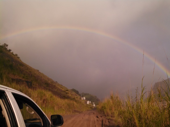
A few weeks ago, when we were driving to one of our dig sites, we noticed a dip in the road that hadn’t been there the previous week. When we returned to the site the next week the dip was lower by at least six inches. The following week I decided driving down that road was not in our best interest but we wanted to investigate. We were able to document cracks and fissures that were several feet long and 4-12 inches wide. The next week there were men surveying the area and the week after that there were excavators and backhoes. I had read about the massive landslides during the construction of the canal and was aware that due to the geology of the area they are an ongoing problem. It was fascinating and I have to admit a bit disconcerting to watch the progression of the landslide and the remedial measures that were taken in response. I was so intrigued I did a little bit of research.


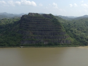
Landslides have always been a problem in the Panama Canal, most notably in the 13-km long section at the southern end of the canal known as the Culebra Cut (also known as Gaillard Cut). The special wonder of the canal is Culebra Cut. It cuts through the continental divide and is the high, hard rock basaltic slopes and the lower, soft shale/clay slopes of the Cucaracha and Culebra Formations that can be seen in picturesque photos of the canal. All the rain and humidity softens the shale into mud and clay. The instability of the mud and clay results in continual landslides. David McCullough in “Path Between The Seas”, his famous book about the building of the Panama Canal, states that all technical problems were small compared to the slides in the cut. Workers on the canal would arrive in the morning and months of digging, as well as equipment, would be completely wiped out by thousands of cubic yards of dirt and rock from slides. The massive slides in the cut also played a big part in the French Canal Company’s inability to complete the canal.
In 1915 the second year of operation, the canal was hit with two major landslides that struck simultaneously. Both the east side and west side of the Culebra Formation slid, resulting in the closure of the canal for seven months. In 1986 a geotechnical advisory board was formed after a major reactivation of the East Cucaracha slide encroached into the navigational channel of the canal and caused a closure of twelve hours.
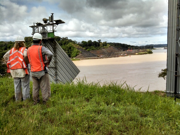
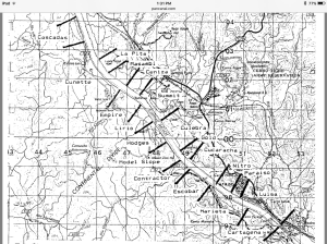
In 1988 a report was issued by Luis D. Alfaro on the risk of landslides in Gaillard Cut. He researched all of the slide events that were documented up to 1986, thirty-one in all. In his report he suggests dividing the cut into zones of relative uniform geological environments to help monitor and document movement. We use these zone names at our dig sites. Today the slopes are monitored constantly through instrumentation and field inspections so remedial measures can be implemented if movement is detected.

image

Culebra Cut

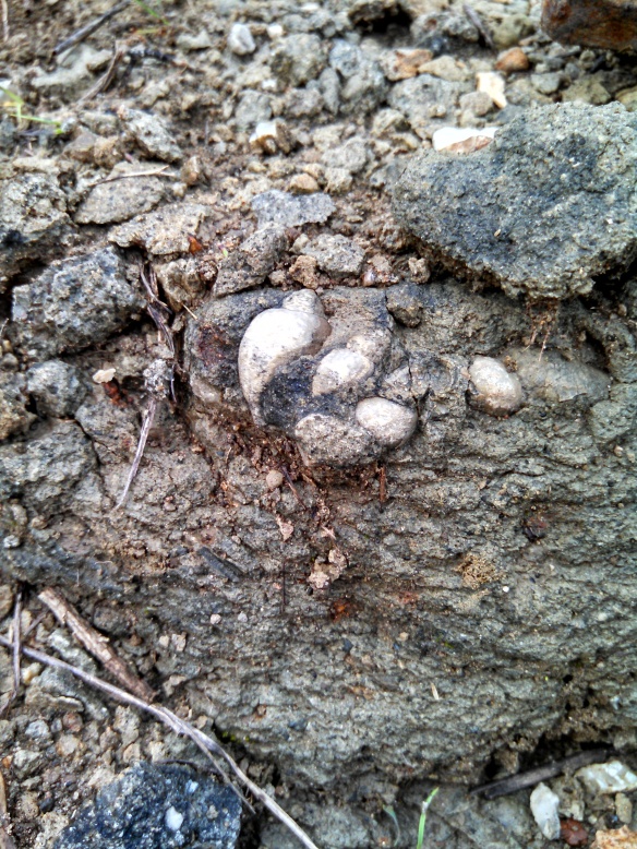
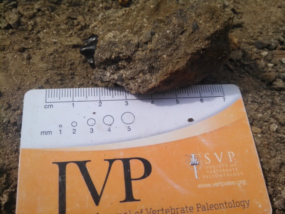
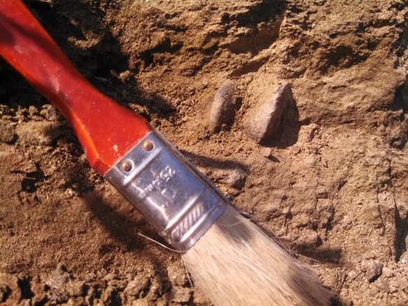
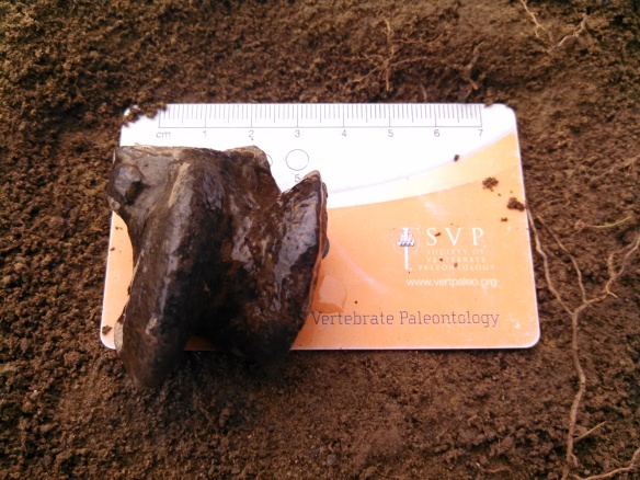
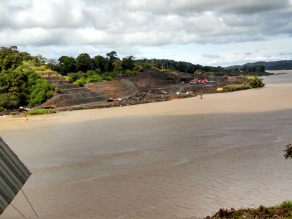
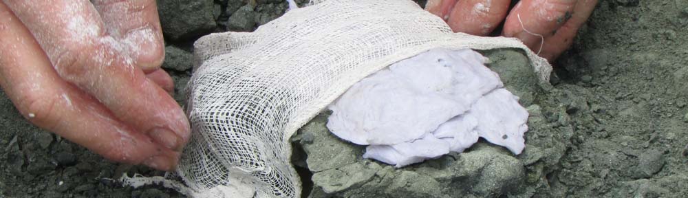
The good news for us is that there is now a newly scraped-clean excavation site for us to investigate for fossils. We went there twice last week and discovered shark teeth, croc teeth, and a bunch of invertebrate fossils. image

Isla Barro Colorado

image

On the boat from Gamboa

Last month some visitors from the States and I had the opportunity to take a three hour guided tour of Barro Colorado Island. One of my friends noted that you should always be Leery of a three hour tour to an island after the fate of the Skipper and Gilligan. But we decided to brave it anyway.

The island was established as a biological reserve in 1923 and has been administered by the Smithsonian since 1946. It is part of the Barro Colorado Nature Monument that includes five surrounding peninsulas and encompasses 12,000 acres. Every year hundreds of scientists come to Panama to do research at the Smithsonian Tropical Research Center on the island.

The island is located in the middle of Lake Gatun, a man-made lake formed when they dammed the Chagres river to build the Panama Canal. The tropical forest on the island is home to a diverse population of wildlife including over 120 species of mammals.

image
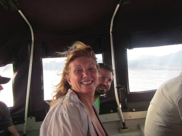
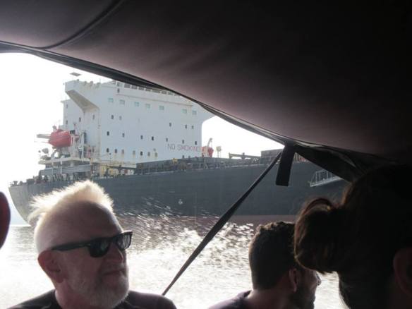
The tour began with an hour long boat ride along the canal to the dock at Barro Colorado. It was fascinating to sail alongside the big ships that were traversing the canal route. My friend is a merchant marine and was able to educate us about the types of ships we were passing and what they might carrying.

We headed out for our hike through the forest. Along the way we were introduced to incredible flora and fauna. We saw roosting fruit bats, eggs of the red eye tree frog, foam nest of the tungara frog, a coati, walking trees, howler monkeys, poisonous caterpillars, a tinamou (a turkey like bird), spiders dining on something deli, leaf cutter ants, and agoutis along with many more amazing plants and animals.

We finished up with a buffet lunch of fish and rice, and a boat ride back to the dock in Gamboa, tired, happy and full of great food! If you get a chance to go on this tour I give it two thumbs up!    (All photos by Sara ElShafie)

Fossil Friday 1/8/16: A protoceratid skull

UF223585

UF 223585, the partial skull of Paratoceras coatesi. You can see the orbital where the eye would have been on this specimen. Photo © VP FLMNH.

Welcome to the first Fossil Friday post of 2016! This week we have an exciting specimen to present: a partial skull of the protoceratid Paratoceras coatesi. This specimen is the holotype of the species and was found in the Escobar Section locality of the Cucaracha Formation (early Miocene).

To learn more about this species of protoceratid, check out one of our previous Fossil Friday posts that includes the paper where it is described.

Studying Panama’s Microfossils

Hello from the lab!

While I spend most of my time in the field looking for new fossils, I also have the opportunity to work on original research while I am working with the PCP-PIRE project. I have previously worked with microfossils, specifically ostracods, so I decided to look at the types of ostracods preserved in the Canal deposits.

In particular, I am looking at the ostracods from the new locality we discovered two weeks ago that is full of gastropods and bivalves. When we returned to the site, I discovered nummulites, which led me to believe that foraminifera and ostracods would be present in the deposit as well. However, these fossils require a microscope to see in detail. I collected four sample bags of sediment from different rock layers in the outcrop, and returned to the lab to process them.

IMG_20151117_084454_802

The new invertebrate locality, in which I am searching for microfossils.

Another intern at the Smithsonian Center for Paleoecology and Archaeology, Andrés Ríos, also studies fossil ostracods, and helped me prepare the sediment to view under the microscope. We used a dilution of hydrogen peroxide to disaggregate the rock. Andrés sieved the sediment into different grain sizes and let the sediment dry in the lab’s drying oven.

Under the microscope, I use a small paint brush to sift through the grains to locate ostracod individuals and place them on a microfossil slide. Though I have only just begun going through the sediment samples, I have found several types of ostracods, both juveniles and adults. The following ostracods are from a portion of one sediment sample I collected.

I will continue to comb through my sediment samples in search of ostracods, and then work on identifying all the different genera present in the new outcrop. With this information, we will be able to identify the type of environment in which the locality was deposited–whether it was marine, brackish, or freshwater–as well as its relative age based on the microfossil biostratigraphy. I’m looking forward to learning more about this new site based on these minuscule fossils!

-Dipa Desai

New Fossil Finds at Puente Centenario

This week we had an exciting time in the field, specifically at our site under Puente Centenario. Under the shadow of the bridge and nestled among tall stands of elephant grass lies a locality deposited there some 14 to 17 million years ago. These fluvial deposits contain the remains of Panama’s Miocene animals and plants: The ancient river or stream carried teeth, bones, leaves, and other remnants, then gently buried them in sediment. After millions of years entrapped in the rock, these fossils are exhumed by our field team.

Our first excursion to this site yielded several teeth from crocodiles, fish, and even one carnivore molar.

IMG_20151202_102637_763

My field supervisor, Jorge Moreno, suspects this is a carnassial molar. 

Teeth are common finds in the field because they are composed of durable enamel that preserves well over time. The enamel also lends a sheen to the fossil which makes it easy to pick out among the dark pebbles and sediment. The color of the fossil tooth is not white, as it was when the animal was alive. When the tooth gets buried, minerals in the surrounding water infiltrate the porous bone and replace the original material, resulting in a darker color.

As our field day was ending, I brushed around the area where I collected the carnassial molar and found something surprising.

IMG_20151202_110426_725

An unknown large bone peeking out from the rock where I discovered the carnivore molar.

We returned the next day to carefully excavate this bone. Not knowing how large this bone was, we systematically removed all the rock above and around it until we approached the bone. To strengthen and stabilize it, Jorge covered the exposed bone in paraloid, a type of thin glue that absorbs into the fossil. Using chisels and brushes, we finally freed the bone from the rock and discovered it to be a large astragalus, or ankle bone.

IMG_20151203_095804_930

Jorge identified the astragalus as possibly belonging to a large, early type of horse.

We are excited to send these finds to the University of Florida for further study, and to head back to the field to find more fossils!

IMG_20151203_072316_312

-Dipa Desai

Exploring the Panama Canal

Hello from the Panama Canal!

I’ve been in Panama for a little less than two months, but every day we head to the field seems like a new adventure uncovering fossils. We usually head out to the field early in the morning, choose a locality, prospect the area, and we dig until lunch. This past week, however, we deviated from our normal routine to scope out some of the new cuts being made along the Canal, and to see if any looked like promising fossil-bearing localities.

IMG_20151118_100911_172

Paris Morgan (left) and Jorge Moreno (right) looking from the east side of the Canal across to the new cuts.

IMG_20151118_100933_268

Close up on the freshly exposed rocks on the west side of the Canal.

We explored both sides of the Canal for outcrops, and ended up finding several potential localities based on their lithology. My personal favorite was an invertebrate site full of gastropods, bivalves, oysters, and even small nummulites!

IMG_20151117_084454_802

Gastropods found at one of the new localities.

We plan on adding these new sites to our PCP-PIRE database, along with each one’s formation, rock type, and a description of the fossils one can find. Hopefully they will yield new fossils that will augment our understanding of Panama’s paleoenvironment!

-Dipa Desai

Mike Kedenburg and Gephen Sadove on the thermochronology of the Azuero Peninsula

Former PCP PIRE geology intern Gephen Sadove and current MS student Mike Kedenburg presented their research on the thermochronology of the Azuero Peninsula of Panama. Gephen and Mike have both written about their research before – Mike wrote about his research here, and Gephen explained about how she worked to process samples for research Part One; Part Two).

Gephen Sadove and Mike Kedenburg at their poster at GSA 2015.

Gephen Sadove and Mike Kedenburg at their poster at GSA 2015.